“طقس لبنان اليوم: رياح خماسينية وغبار مع ارتفاع درجات الحرارة ثم تقلبات جوية مفاجئة!”
نشرة الطقس الصادرة عن دائرة التقديرات في مصلحة الأرصاد الجوية في لبنان
الجمعة: 28 آذار 2025
الحالة العامة:
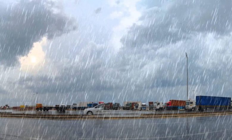
يتأثر لبنان والحوض الشرقي للمتوسط برياح خماسينية دافئة قادمة من شمال أفريقيا، محمّلة بطبقات من الغبار، مما يؤدي إلى ارتفاع ملحوظ في درجات الحرارة، حيث تصل ذروتها اليوم الجمعة وتتجاوز الـ 32 درجة في الجنوب اللبناني. ومع حلول ليل الجمعة إلى السبت، ستنخفض درجات الحرارة تدريجيًا وبسرعة بمقدار 10 درجات، ليصبح الطقس متقلبًا مع تساقط أمطار متفرقة وموحلة، وزيادة في نسبة الرطوبة مما يؤدي إلى تكون الضباب وسوء الرؤية.
ملاحظة:
معدل درجات الحرارة لشهر آذار:
-
بيروت بين 13 و22 درجة.
-
طرابلس بين 11 و20 درجة.
-
زحلة بين 6 و17 درجة.
الطقس المتوقع في لبنان:
الجمعة:
غائم إجمالًا مع سحب مرتفعة، يصاحبه رطوبة منخفضة، بالإضافة إلى طبقات من الغبار التي تستمر في التأثير على الأجواء. تبقى درجات الحرارة أعلى من معدلاتها الموسمية بنحو 10 درجات، لكن درجات الحرارة ستنخفض بشكل سريع مساءً. الرياح تنشط بشكل خاص شمال البلاد لتصل سرعتها أحيانًا إلى 60 كم/س، مما يرفع من نسبة الرطوبة ويؤدي إلى تكوّن الضباب الكثيف على مستويات منخفضة ويؤثر على الرؤية.
السبت:
غائم جزئيًا إلى غائم مع ضباب كثيف على المرتفعات، وانخفاض ملحوظ في درجات الحرارة، التي ستعود إلى معدلاتها الموسمية. هناك احتمالية لتساقط أمطار خفيفة متفرقة وموحلة، مع احتمال حدوث برق ورعد في المناطق الداخلية، بالإضافة إلى رياح ناشطة.
الأحد:
غائم جزئيًا مع استمرار الضباب على المرتفعات، دون تعديل يذكر في درجات الحرارة على الساحل، بينما ستنخفض في المناطق الداخلية وعلى الجبال.
الإثنين:
غائم جزئيًا مع ضباب على المرتفعات، وارتفاع في درجات الحرارة، بينما تنخفض نسبة الرطوبة وتنشط الرياح خلال فترة بعد الظهر.
درجات الحرارة المتوقعة:
-
الجمعة:
-
صور: 23/31
-
بيروت: 22/31
-
طرابلس: 14/28
-
بيصور: 19/28
-
قرطبا: 19/28
-
زحلة: 10/25
-
-
السبت:
-
صور: 15/24
-
بيروت: 15/24
-
طرابلس: 11/20
-
بيصور: 14/19
-
قرطبا: 8/18
-
زحلة: 10/25
-
كمية المتساقطات:
-
طرابلس: 0 ملم (المتراكم لغاية اليوم: 490.7 ملم)
-
بيروت: 0 ملم (المتراكم لغاية اليوم: 367.1 ملم)
-
زحلة: 0 ملم (المتراكم لغاية اليوم: 251 ملم)
الرياح السطحية:
جنوبية غربية، سرعتها بين 10 و35 كم/س، تنشط مساءً خاصة شمال البلاد، حيث تصل أحيانًا إلى 60 كم/س.
الانقشاع:
متوسط إلى سيء بسبب الغبار في الأجواء.
الرطوبة النسبية على الساحل:
بين 35% و90%.
حال البحر:
مائج إجمالاً.
حرارة سطح الماء: 20°C.
الضغط الجوي: 1010 HPA (ما يعادل 758 ملم زئبق).
مواقيت الشمس:
-
شروق الشمس: 05:32
-
غروب الشمس: 17:55
الطقس في لبنان: توقعات وتحذيرات
تستمر التأثيرات الخماسينية على لبنان، مع رياح محملة بالغبار، مما يؤدي إلى زيادة درجات الحرارة في بداية اليوم، لتعود وتنخفض بشكل سريع مساءً. يُتوقع حدوث تقلبات جوية مع هطول أمطار متفرقة، ويُنصح المواطنون بالانتباه لتوجيهات الأرصاد الجوية.
Weather Bulletin Issued by the Directorate of Forecasting at the Lebanese Meteorological Services
Friday: March 28, 2025
General Situation:
Lebanon and the eastern Mediterranean basin are under the influence of warm Khamsin winds from North Africa, carrying dust layers, resulting in a noticeable rise in temperatures. The temperature will peak today, Friday, exceeding 32°C, especially in southern Lebanon. From Friday night to Saturday, temperatures will drop gradually and rapidly by about 10°C, with the weather turning unstable, accompanied by scattered and muddy rain, and an increase in humidity, leading to the formation of fog and poor visibility.
Note:
Average temperatures for March:
-
Beirut: between 13°C and 22°C.
-
Tripoli: between 11°C and 20°C.
-
Zahle: between 6°C and 17°C.
Expected Weather in Lebanon:
Friday:
Overall cloudy with high clouds, accompanied by low humidity and dust layers. Temperatures will remain 10°C higher than the seasonal averages but will drop rapidly in the evening. Winds will intensify, especially in the northern regions, reaching speeds of up to 60 km/h, causing higher humidity and forming dense fog at lower altitudes, reducing visibility.
Saturday:
Partly to mostly cloudy with dense fog starting from lower levels, and a noticeable decrease in temperatures, returning to seasonal averages. Light, scattered, muddy rain is expected, with the possibility of lightning and thunder, especially inland, along with active winds.
Sunday:
Partly cloudy with fog on the mountain tops and no significant changes in coastal temperatures, while temperatures will drop inland and in the mountains.
Monday:
Partly cloudy with fog on the mountain tops, and an increase in temperatures. Humidity will decrease, and winds will become active in the afternoon.
Expected Temperatures:
-
Friday:
-
Tyre: 23°C / 31°C
-
Beirut: 22°C / 31°C
-
Tripoli: 14°C / 28°C
-
Bissour: 19°C / 28°C
-
Qartaba: 19°C / 28°C
-
Zahle: 10°C / 25°C
-
-
Saturday:
-
Tyre: 15°C / 24°C
-
Beirut: 15°C / 24°C
-
Tripoli: 11°C / 20°C
-
Bissour: 14°C / 19°C
-
Qartaba: 8°C / 18°C
-
Zahle: 10°C / 25°C
-
Rainfall Amounts:
-
Tripoli: 0 mm (Accumulated to date: 490.7 mm)
-
Beirut: 0 mm (Accumulated to date: 367.1 mm)
-
Zahle: 0 mm (Accumulated to date: 251 mm)
Surface Winds:
Southwesterly, with speeds between 10 and 35 km/h, intensifying in the evening, especially in the northern regions, reaching up to 60 km/h.
Visibility:
Moderate to poor due to dust in the atmosphere.
Relative Humidity on the Coast:
Between 35% and 90%.
Sea Conditions:
Generally rough.
Sea Surface Temperature: 20°C.
Atmospheric Pressure: 1010 HPA (equivalent to 758 mmHg).
Sunrise and Sunset Times:
-
Sunrise: 05:32
-
Sunset: 17:55
Translated by international scopes team
المصدر: رصد موقع سكوبات عالمية