
“نشرة الطقس في لبنان: توقعات بهطول أمطار وثلوج على المرتفعات بدءاً من الأربعاء”
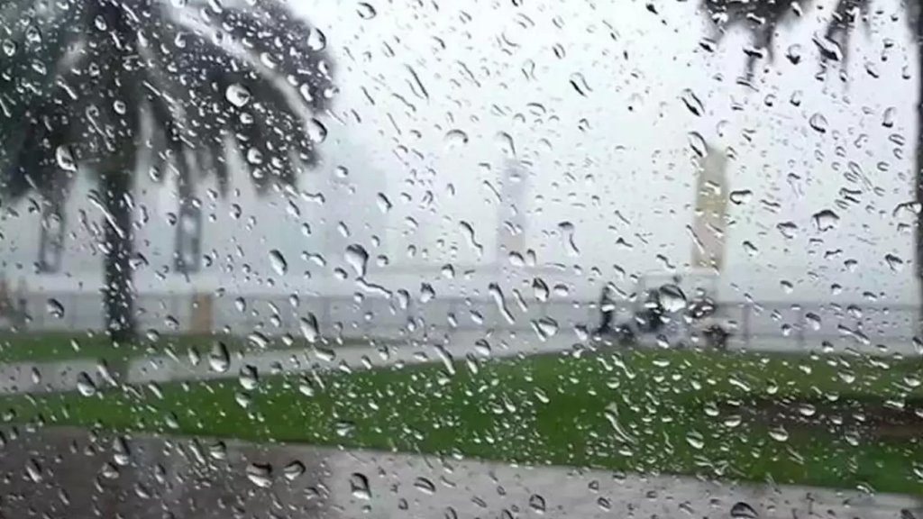
تستمر تأثيرات الكتل الهوائية الدافئة القادمة من شمال أفريقيا على لبنان والحوض الشرقي للمتوسط، مما يؤدي إلى ارتفاع ملحوظ في درجات الحرارة، والتي تجاوزت معدلاتها الموسمية بحوالي 8 درجات مئوية. هذه الأجواء ستستمر حتى يوم الثلاثاء المقبل، حيث سيبدأ تأثير منخفض جوي قادم من شمال تركيا، ما سيؤدي إلى تحولات كبيرة في الطقس مع انخفاض ملموس في درجات الحرارة وهطول أمطار متفرقة، خاصة في المناطق الجبلية، كما ستتساقط الثلوج على المرتفعات.
التوقعات التفصيلية:
-
الإثنين (17 مارس 2025): الطقس سيكون غائمًا جزئيًا إلى غائم بسحب متوسطة ومرتفعة مع ارتفاع طفيف في درجات الحرارة، وستبقى الرطوبة منخفضة. الرياح ستكون نشطة في المناطق الشمالية.
-
الثلاثاء (18 مارس 2025): الطقس غائم جزئيًا إلى غائم مع بداية انخفاض ملحوظ في درجات الحرارة، مع فرص لتساقط أمطار خفيفة متفرقة، يرافقها برق ورعد خاصة في المناطق الجبلية. الرياح ستنشط بشكل ملحوظ، تصل سرعتها إلى 60 كم/س شمالاً مع ظهور طبقات من الغبار وارتفاع موج البحر.
-
الأربعاء (19 مارس 2025): الطقس سيكون غائمًا مع انخفاض ملحوظ إضافي في درجات الحرارة لتعود إلى معدلاتها الموسمية، مع هطول أمطار متفرقة. ستشتد الأمطار مساءً مع فرصة لتساقط حبات من البرد، كما سيتساقط الثلج من ارتفاع 1800 متر على أن يتدنى إلى 1100 متر في المناطق الشمالية.
-
الخميس (20 مارس 2025): غائم جزئيًا إلى غائم مع استمرار انخفاض درجات الحرارة وتساقط أمطار متفرقة، مع برق ورعد. الثلوج ستتساقط على ارتفاع 1000 متر في المناطق الشمالية، وقد تلامس 800 متر في بعض الأماكن. الرياح ستكون نشطة وستصل سرعتها إلى 75 كم/س، مما سيرتفع مع ارتفاع موج البحر.
درجات الحرارة المتوقعة:
| المنطقة | الإثنين | الثلاثاء |
|---|---|---|
| صور | 16/28 | 15/26 |
| بيروت | 16/28 | 16/27 |
| طرابلس | 13/27 | 13/26 |
| بيصور | 17/27 | 17/25 |
| قرطبا | 17/27 | 17/25 |
| زحلة | 11/30 | 11/26 |
الرياح السطحية: شمالية شرقية صباحًا، متقلبة ليلاً، سرعتها تتراوح بين 15 و 35 كم/س.
حال البحر: منخفض إلى مائج أحيانًا، مع حرارة سطح الماء 19 درجة مئوية.
الضغط الجوي: 1015 HPA (أي ما يعادل 761 ملم زئبق).
ساعة شروق الشمس: 05:45.
ساعة غروب الشمس: 17:48.
“Lebanon Weather Forecast: Rain and Snow Expected on Wednesday”
Lebanon and the eastern Mediterranean basin are still under the influence of warm air masses coming from North Africa, leading to a significant rise in temperatures, which have surpassed seasonal averages by about 8 degrees Celsius. This weather pattern is expected to continue until Tuesday, when a low-pressure system from northern Turkey will begin to impact the region, resulting in a notable temperature drop and scattered rain showers, especially in mountainous areas. Snow will fall at higher elevations.
Detailed Forecast:
-
Monday, March 17, 2025: The weather will be partly to mostly cloudy with medium and high clouds. Temperatures will rise slightly, and humidity will remain low. Winds will be active in northern regions.
-
Tuesday, March 18, 2025: The weather will be partly to mostly cloudy with a noticeable decrease in temperatures, with light scattered rain showers, accompanied by thunder and lightning, especially in mountainous areas. Winds will pick up, reaching speeds of up to 60 km/h in the north, with dust layers and rising sea waves.
-
Wednesday, March 19, 2025: The weather will be mostly cloudy with a further significant decrease in temperatures, returning to seasonal averages. Scattered rain will continue, intensifying in the evening, with the possibility of hail. Snow will start from an elevation of 1800 meters and will decrease to 1100 meters, particularly in northern regions.
-
Thursday, March 20, 2025: The weather will be partly to mostly cloudy with an additional decrease in temperatures and scattered rain, accompanied by thunder and lightning. Snow will fall at 1000 meters in northern areas, possibly reaching 800 meters. Winds will intensify, reaching speeds of 75 km/h, with rising sea waves.
Expected Temperatures:
| Area | Monday | Tuesday |
|---|---|---|
| Tyre | 16/28 | 15/26 |
| Beirut | 16/28 | 16/27 |
| Tripoli | 13/27 | 13/26 |
| Bishmizzine | 17/27 | 17/25 |
| Qartaba | 17/27 | 17/25 |
| Zahle | 11/30 | 11/26 |
Surface Winds: Northeasterly in the morning, becoming variable at night, with speeds ranging from 15 to 35 km/h.
Sea State: Calm to occasionally rough, with a sea surface temperature of 19°C.
Atmospheric Pressure: 1015 HPA (equivalent to 761 mm Hg).
Sunrise: 05:45.
Sunset: 17:48.
Translated and Detected by international scopes team
المصدر: رصد موقع سكوبات عالمية